Robotic Drone Technology
Make the World Your Digital Asset
Capture, analyze and visualize your environment with NCTI innovations for an easy to use mapping software developed to help your industry transform real-world scenarios into digital assets
Plan. Process. Analyze and Execute.
Mission Planning
Data Acquisition
Area Mapping
Data Analysis
Enable Your Digital World
Mission Type
Streamlined Workflows, Highest Accuracy Results

Unparalleled efficiency and user experience
Import images with ease while navigating the intuitively designed interface effortlessly.
Bulk process up to 400 images/1 GB of RAM, minimizing the wait time between field work and digital visualization.
Run reconstruction missions by employing multiple graphics cards simultaneously to improve efficiency.
Meet and exceed your project standards
Generate highly detailed 2D orthomosaics and 3D models.
All enhanced absolute accuracy by setting Ground Control Points (GCPs) and checkpoints, so you can measure and inspect with ease.
View quality reports of your mission(s) to ensure the results meet your accuracy standards.
Compatibility and flexibility
Convert the coordinates of your maps and models into 8500+ major coordinate systems by simply selecting the output that fits your needs.
Incorporate POS data, GCPs, or both sets of data to create georeferenced maps and models with enhanced accuracy directly in the target coordinate system required by the project.
Mapping in Real Time
2D Maps
Data Acquisition
Quickly generate a 2D orthomosaic of the selected area in real-time. Not only is this ideal for creating detailed flight paths in remote areas but it’s also useful for time-sensitive missions that require quick decision-making on site.
3D Reconstruction
Generate high resolution orthomosaics, enabling you to get detailed and accurate measurement results for all your critical projects.
Multispectral Reconstruction
Process multispectral images to generate vegetation index maps with NCTI. Create maps for variable rate application using NCTI drones to improve crop yields and lower costs.
3D Maps
Real-time 3D Point Cloud
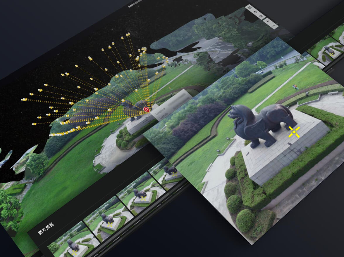
When efficiency is key, quickly render and visualize a 3D point cloud of the mapped area. Make decisions based on the preliminary model and check for completeness immediately or plan 3D flights on-site.
3D Reconstruction
Get sharp and realistic representations of your surroundings throughout various industrial applications, be it accident reconstruction, recreating thin power lines and complex vertical structures, managing major construction projects and more. The CUDA-based reconstruction algorithms are capable of quickly processing large amounts of data to deliver quality results.
With Regional interest, image reconstruction can be performed to specific targets. This saves processing time and improves efficiency, and generates a clearer model or point cloud.
Data Analysis
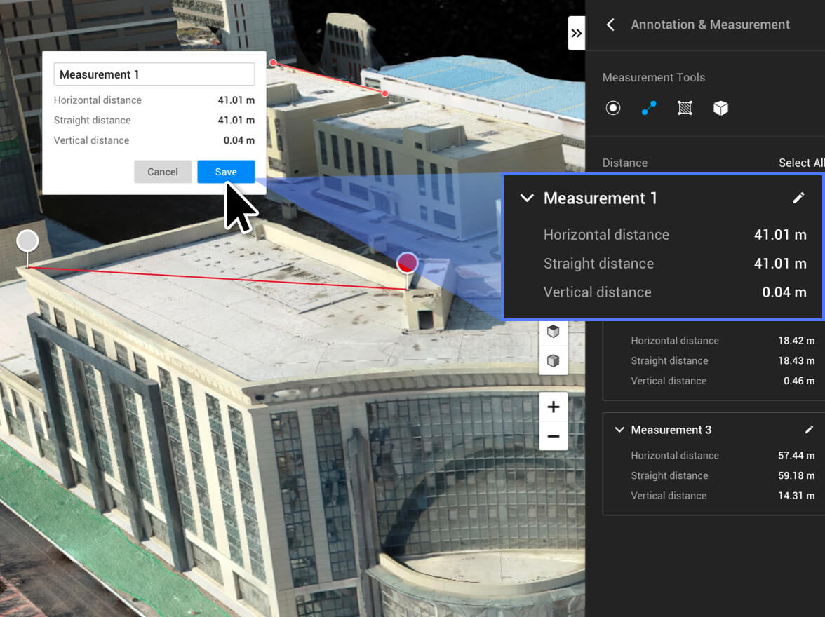
2D & 3D Measurements
Acquire key dimensions across an array of terrains with easy-to-use analysis tools that enable you to obtain a variety of measurement data based on linear, area and volumetric measurements.
Annotation
Edit labels of measurements on existing models, which can be used for reporting and improving communication throughout ongoing projects.
Photo Inspection & Analytics
Closely inspect every photo of the model so you can pinpoint and highlight any critical elements in the real world.
Seamless Connection with Your Fleet of NCTI Drones
NCTI enables compatible drones in line with your requirements Series drones:
NCTI RTK (Remote Controller)
NCTI-1 Pro
NCTI-2 Pro
NCTI-3 Pro
NCTI-9 Pro